
Sewer map
Here's something that I had wanted to post a while ago, but wasn't sure how to do it.
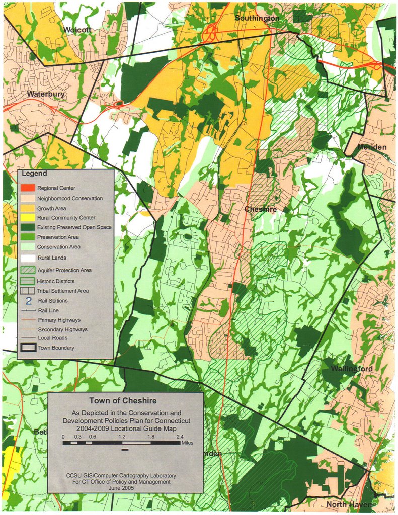
This is a map of Cheshire's sewer system. If you click on the map, you'll be able to read the legend.
Tim White
State Representative candidate (R-89)
Bethany, Cheshire & Prospect
TimWhite98@yahoo.com
4 comments:
Tim,
This is actually the state plan of conservation for Cheshire. It is a guideline by the state for areas in which growth can occur and areas wher develoment should be limited. When I say guideline, I use that term with some irony. If Cheshire chose not follow the plan, then all state fuinding to Cheshire could be a risk.
The connection to the sewer system is again limits where new extensions or mains can be placed. For a map of the system, you and readers should stop into town hall and see public works.
anon... yes. you're right. It is what you said.
Tim W
Can the town change the state map? Are we limited by the state? Tim should we change the state map?
anon 3:26pm...
I understand the town can request changes. And often such changes are granted.
My thoughts on changing the map...
Cheshire people are closer to this than anyone in Hartford. So while I'd need to learn more, my immediate feeling is that it would make sense to get the state map to more closely resemble the town map... rather than the other way around.
Post a Comment